Education
- VSPK International School
- Ryan International School
- Delhi Public School
- Bal Bharati Public School
- Maxfort School
Powered by Froala Editor
Discover Brokersaathi Services
CRM
Client management, lead tracking, data analysis.
Property Management
Efficient oversight, tenant management, maintenance.
Lead Generation
Attracting prospects, nurturing leads, conversion.
Hiring
Recruitment, selection, onboarding, talent acquisition
Home Loan
Financing options, approval process, interest rates.

Become A Real Estate Firm
Establish, network, market, manage properties.
Discover
Maps
Explore our collection of Gurugram maps
Web Stories
Discover engaging narratives and immersive experiences through our web stories.
Our Story
Our story embodies a visionary approach, emphasizing client-centric strategies and strategic growth to drive success.
Contact Us
For personalized assistance and inquiries, please feel free to contact us directly.
Blogs
Stay informed with our latest insights, tips, and updates on real estate trends and market analysis.
Map
Explore the master plan, connectivity, and key landmarks of this area.

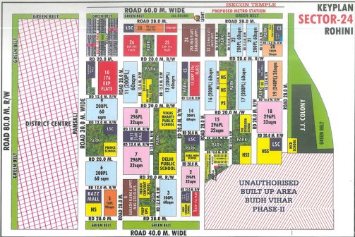
Delhi
The Sector 24 Rohini Map helps residents, visitors, and property buyers understand the complete layout, road connectivity, nearby landmarks, metro access, and residential planning of this well-developed area in North West Delhi. Sector 24 Rohini is known for its organized infrastructure, residential societies, educational institutions, parks, and easy connectivity to major parts of Delhi.
The Rohini Sector 24 Map provides a clear view of internal roads, DDA pockets, nearby markets, schools, hospitals, and surrounding sectors. The locality enjoys good connectivity through major roads and nearby metro stations, making daily travel convenient for families, students, and working professionals.
The Layout Plan of Sector 24 Rohini reflects a properly planned residential sector with wide roads, green parks, commercial spaces, schools, and community facilities. The area includes DDA flats, builder floors, independent houses, and group housing societies, making it suitable for different types of homebuyers.
Powered by Froala Editor
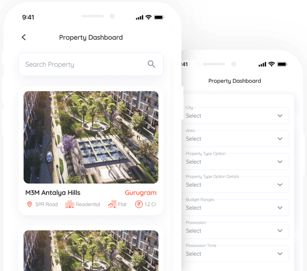
Properties
Check Property Rates & Trends for any locality or society
Nearby
Powered by Froala Editor
Powered by Froala Editor
Powered by Froala Editor
Get personalized property recommendations from our expert team
Fill the form below and we'll get back to you within 24 hours
Your information is secure and will not be shared